Housing delivery is unquestionably at the top of the national agenda. But as the government's New Towns Programme gathers pace and Housing Conference returned to Manchester this month, the conversation is increasingly turning to a more difficult question:
What makes a new neighbourhood successful?
Exciting initiatives like CyanLines are seeking to answer this question, with its vision for over 100 miles of active travel routes, to create better, more connected places. Simply put, its vision isn’t about creating new spaces but better connecting existing ones. Because connectivity is at the heart of successful neighbourhoods.
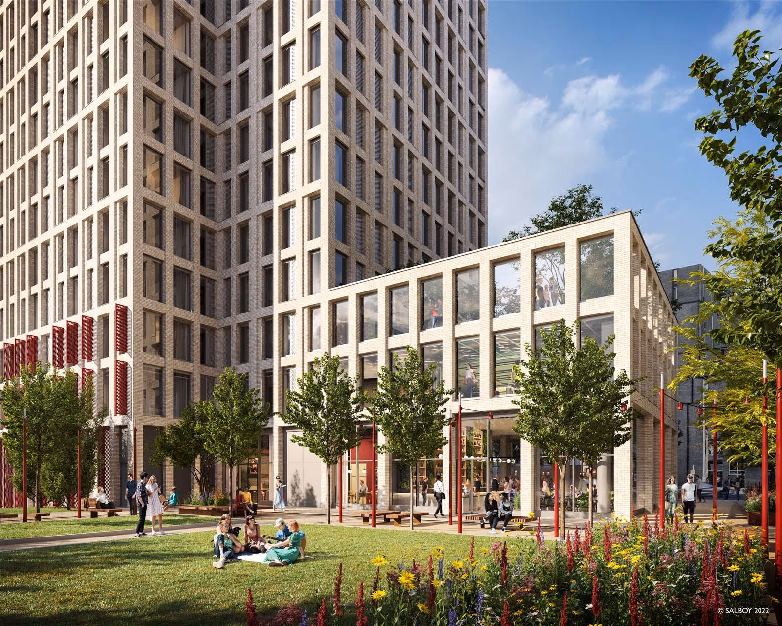
Gone are the days when housing estates feel like gated communities. Good urban design goes beyond housing numbers and focuses on connecting the spaces between the homes. Successful new neighbourhoods extend cities rather than sit alongside them.
This challenge is particularly relevant as the government's New Towns Programme gathers pace. Some of the most interesting proposals aren't new settlements, but new neighbourhoods embedded within existing cities. Projects such as Victoria North in Manchester and Leeds' South Bank will deliver thousands of homes while reshaping the urban fabric around them.
The success of schemes like these will depend not only on the quality of the homes they provide, but on how effectively they connect to places that already exist.
While a site’s “red line plan” is an essential element of every planning application, the experience of living somewhere extends far beyond the site boundary, to schools, parks, high streets and places of work.
When these connections are overlooked, developments can become islands: physically adjacent to existing communities, but separated by busy roads, fragmented routes or unclear gateways.
Good connectivity builds networks of movement that help people understand how places relate to one another. When individual destinations are linked through a coherent network of routes and public spaces, they become greater than the sum of their parts and help new neighbourhoods feel connected from day one.
This is where wayfinding comes into its own.
The everyday journeys we make shape our experience of place. The daily school run, the cycle to the station or the evening dog walk all help form our mental map of a neighbourhood. This is why prioritising the pedestrian experience from the outset is so important.
Masterplans used to start from a car-first mentality. Now we know better. When the masterplanning process prioritises walking and cycling from the outset, it strengthens legibility and creates places that are easier to navigate, healthier to live in and more socially connected.
Of course, different users experience neighbourhoods in different ways. A parent walking to school, a commuter cycling to the station, an older resident accessing local services or a visitor arriving for the first time will all navigate a place differently. Wayfinding is the discipline that puts the user first, and takes the time to understand, rather than assume, the user’s perspective and needs.

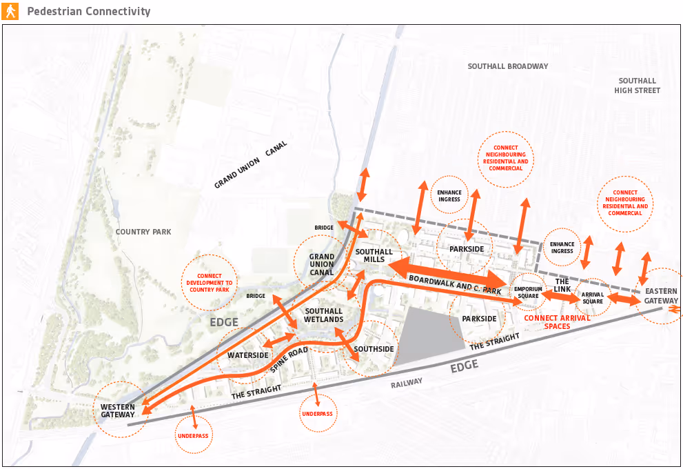
Working on the early masterplanning stages of SmartCity, Malta, while the road layouts and development blocks were still being determined, we considered desire lines and removed barriers to movement. The vehicular routes were designed to be slightly less direct while the most direct pedestrian and cycle routes were planned in to achieve good connectivity.
Good wayfinding is built on a strategy that understands its users and the journeys they want to make, long before the first sign is installed.
Beyond physical connectivity, people also need to understand how places fit together in order to move freely.
Legible places are easy to read. They use landmarks, gateways, views and character areas to help people build a mental map of where they are and where they can go next. Public realm interventions, planting, materials and carefully considered wayfinding can all contribute to this sense of orientation.
Legibility is ultimately about confidence. When people understand where they are, where they are heading and what they might discover along the way, they are far more likely to walk further, explore new routes and make use of the spaces around them.
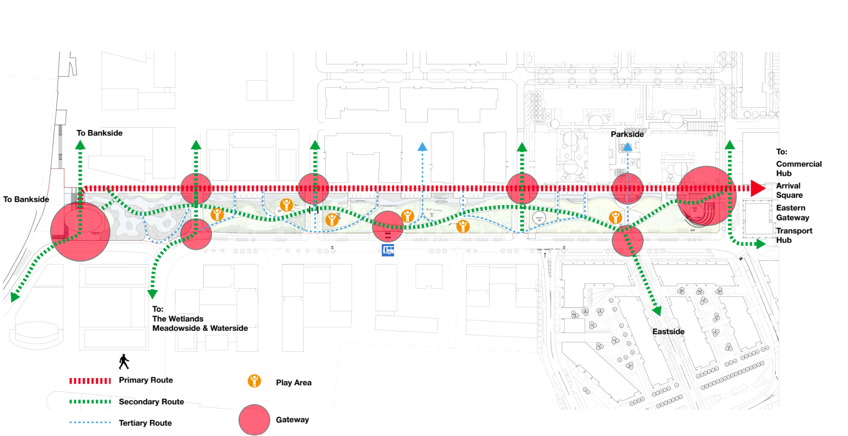
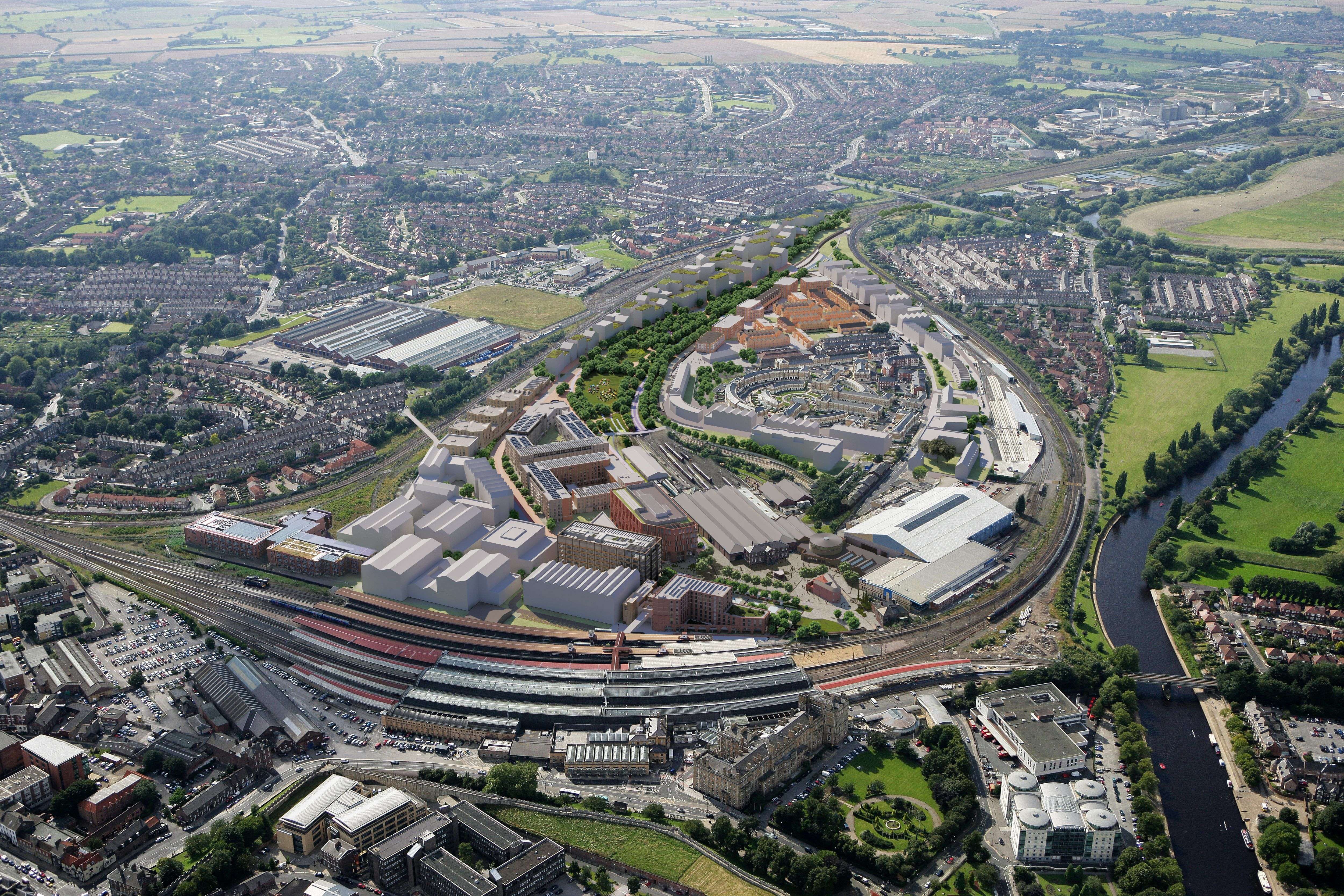
Our work supporting the early masterplanning stages at York Central has tackled these questions of connectivity head on. The development sits between an existing residential community, Leeman Road, and the wider city centre. Maintaining Leeman Road’s links to the wider city is absolutely crucial so our wayfinding strategy has focused on strengthening movement and permeability so that delivery at York Central enhances connections rather than creating new edges.
At a time when housing delivery is under intense scrutiny, it's worth remembering that people do not simply experience a place through the buildings themselves. Streets, parks, squares, green corridors and publicr outes have just as much influence on whether somewhere feels welcoming and connected.
Landscape architects, masterplanners and wayfinders have a crucial role to play here.
Green walking and cycling corridors can connect new communities to existing ones. They can also connect people with nature, improving wellbeing and encouraging exploration beyond familiar routes. Public spaces can become shared destinations rather than boundaries. Existing neighbourhood assets, from local high streets to parks and community facilities, should be woven into the daily life of new residents.
The nationwide push for more housing growth presents an opportunity to create places that are more connected, healthier and easier to navigate. But it won’t happen by accident. Achieving the vision of better, more connected places requires us to proactively look beyond site boundaries and consider how people move through the wider city.
Wayfinding is fundamental to making this possible. Brought in early, it supports active travel, strengthens legibility and helps residents build confidence in their surroundings. Most importantly, it encourages people to explore, connect and feel part of something larger than their immediate neighbourhood.
As new towns and urban regeneration projects continue to move forward across the country, the challenge is not simply where we build homes, but how we ensure those places become part of the communities around them. Strategic wayfinding provides the connective tissue between new and existing communities, helping individual places become part of a coherent whole.