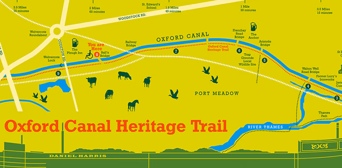
Oxford County Council and the Canal and River Trust needed a wayfinding scheme to raise the profile of the final 3-mile stretch of the 77-mile Oxford Canal.


We produced our designs in conjunction with the Heritage-Lottery-funded Oxford Canal Heritage Project, which worked with communities to produce information about the history and natural environment of the Oxford Canal. The project involved a brand refresh, the design of new post and lectern signs, and new graphics and mapping. The lectern signs included a full map including interpretive images and building elevations.


The signs include QR codes which visitors can scan with their smartphones to access an auditory history of the location or a nice trail guide.