The art of rural wayfinding
We often talk about our work in urban areas, supporting regeneration proposals, improving legibility and navigation across town centres.
But a good portion of our work is distinctly more scenic.
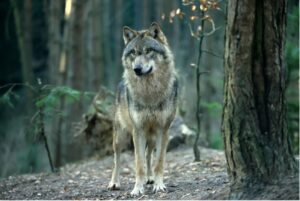
This month we’re stepping away from hubbub of urban living and slowing down to reflect on what makes for a good rural wayfinding project.
No two projects are the same (that’s why we love our job), but there are some traits which distinguish rural projects from their urban cousins. The difference lies in storytelling, how we approach navigating on a bigger scale, and the importance of forging a connection to the natural world.
It’s all about storytelling
Our main focus in a city is usually to help visitors get from A to B.
In rural locations it’s more about retelling the story of the place.
We aim to uncover the stories – and legends – of a place and bring them to life. This is what we like to call interpretation. We ask questions like:
What’s different about this place?
What are the local stories?
What is this place known for?
It’s not just about getting from A to B, it’s getting from A to B and learning something along the way, often from the past.
Sometimes, interpretation looks at where a place is going, particularly one that’s lost its reason for being. We ask how is it moving on, and what new things are happening.
Interpretation, really, is about getting people to understand the context of where they are and what is special about the place. Heritage often has a lot to do with it, but it’s not just a history lesson.
Sue Manley, Strategic Director
Ireland’s Ancient East is rich with stories and this project was a deep dive into Ireland’s past. The brief was to use wayfinding to cross-sell lesser-known destinations. Our award-winning scheme narrated the rich history of the region, firing up people’s imaginations for places they might otherwise have overlooked and encouraging them to explore off the beaten track.
These signs were not just informational; they were an invitation to explore beyond the well-trodden path, guiding visitors on a journey through time.

Staying on the Emerald Isle, our Blueways and Greenways project retold the stories of the railways, the routes of which the greenways now follow. The canal network also holds a rich seam of history, so there was plenty to showcase.
Users of these greenways and blueways don’t particularly need directions about where they are, but interpretation boards enhance users’ connection, and therefore enjoyment, of the place.

And navigation on a bigger scale
Urban wayfinding is man-made, with buildings, structures and the street patterns giving “natural” cues and helping to orientate visitors.
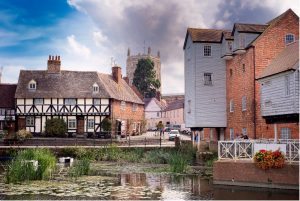
A rural context, on the other hand, can be quite different.
Natural orientation cues in open spaces are often more limited to informal sheep tracks or, if you’re lucky, a waterway. Because of this, our work on larger, natural spaces like the Manx Rural Route and Carnoustie’s circular town trail requires a different approach to navigation.
Carnoustie’s circular route is predominantly a walking trail guided by way markers, literally pointing people in the right direction. And while there is an element of interpretation, these locations are remote so we need to direct people there.


The Isle of Man’s Rural Routes cover a vast range of contexts, eg forests, glens, open countryside and coastal areas so our signage needed to be versatile to adapt to a range of environments.
A greater connection to the natural world
In these contexts, visitors experience a stronger connection to the natural world. So, it’s important that our wayfinding interventions respond, through the design and use of materials, sensitively to their surroundings.
At the Royal Botanic Gardens at Kew, our design incorporates natural materials and a traditional method of fixing the structures into the ground that side steps the need for concrete – something that would have jarred with the Gardens’ overarching ambitions to reduce its carbon footprint.

And when it comes to new developments like urban extensions, even these places have a history and a story to uncover. While it’s important to develop a place brand, but you must still root it in something from its past. We work hard to highlight and celebrate the stories that make these places special and make sure that our wayfinding strategy – through the sign design, graphics and interpretation information – responds and helps visitors to connect with the place.
Maybe it’s the local architecture, maybe it’s the historic river crossing. In the case of Berewood, it is built on the former floodplain, and has a huge amount of ecological capital. So, the interpretation panels at Berewood tell the story of how the site used to look, as well as help people connect with their natural surroundings through the interpretation panels.
There’s no doubt that rural places are distinct from their urban cousins. When we focus on storytelling and forging a strong connection to the natural assets that it comprises, we can help elevate the experience for visitors so that they connect with it, stay a little longer and walk a little further.
Let us help you celebrate the stories of your rural place and improve your visitor experience. Get in touch to discuss it more, at 0161 241 3174.